Upper Mustang is a high-altitude region in northern Nepal, known for its dry Trans-Himalayan landscapes, ancient settlements, Buddhist monasteries and historic walled city of Lo Manthang. Understanding the height of Upper Mustang is important when planning a trek because elevation affects walking pace, acclimatization, temperature and the amount of time needed to explore the region comfortably.
One important distinction: the height of Upper Mustang is not a single number. The region includes river valleys, traditional villages, high mountain passes and settlements at different elevations. Lo Manthang, the principal destination on the classic trek, is commonly listed at approximately 3,800–3,840 metres above sea level, while some trekking routes cross passes above 4,000 metres. Nepal Tourism Board describes Upper Mustang as a geographically Tibetan Plateau-like region within Nepal’s Himalayan landscape.
This guide explains the main elevations, how altitude changes along the trekking route, what the figures mean for trekkers, and how to prepare for the conditions in Upper Mustang.
How High Is Upper Mustang?
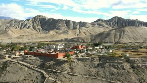
Upper Mustang is generally trekked at elevations of approximately 2,800–4,000 metres, depending on the route and the day’s highest point. Lo Manthang sits at roughly 3,800 metres, and alternative trails may climb higher mountain passes before descending into the next settlement.
For practical planning, distinguish three measurements:
-
Settlement elevation: the approximate height of a village where you stop or spend the night.
-
Maximum daily elevation: the highest point reached during a day’s walk, which may be considerably higher than the overnight stop.
-
Sleeping elevation: the altitude at which you spend the night, an important consideration for acclimatization.
These measurements are not interchangeable. A trekker may cross a pass at more than 4,000 metres but sleep in a village several hundred metres lower.
Upper Mustang Elevation Table: Key Villages and Trekking Points
The following table provides a practical elevation reference for the classic Upper Mustang trekking route. Figures are approximate and may vary between maps, GPS measurements and individual itineraries.
| Location | Approx. elevation | Approx. elevation in feet |
|---|---|---|
| Jomsom | 2,720 m | 8,924 ft |
| Kagbeni | 2,810 m | 9,219 ft |
| Chele | 3,050 m | 10,007 ft |
| Syangboche | 3,475–3,800 m | 11,401–12,467 ft |
| Ghami | 3,520 m | 11,549 ft |
| Charang (Tsarang) | 3,560 m | 11,680 ft |
| Lo Manthang | 3,810–3,840 m | 12,500–12,598 ft |
| Dhakmar | 3,820 m | 12,533 ft |
| Nyi La Pass | Approximately 4,000 m | 13,123 ft |
| Chogo La Pass | Approximately 4,250–4,300 m, route-dependent | 13,944–14,108 ft |
Why are there different elevation figures for the same place?
Some itineraries list Lo Manthang at 3,810 m, while others use 3,840 m. These small differences can arise from mapping sources, measurement points and rounding. The same issue occurs at Syangboche, where a village or overnight stop may be recorded separately from a nearby pass or high point.
For a published itinerary, use one consistent elevation source wherever possible. If your company’s guides use GPS-verified elevations for the exact overnight lodges and passes, those figures are preferable for route-specific planning.
Do not describe the highest overnight stop as the highest point of the trek. A route that crosses Chogo La, for example, may reach considerably higher terrain than the altitude at which trekkers sleep in Dhakmar or Lo Manthang.
Where Is Upper Mustang Located?
Upper Mustang lies in the northern part of Nepal’s Mustang District, north of the Annapurna and Dhaulagiri mountain ranges. The region borders the Tibetan Plateau and sits within the rain shadow of the Himalayas.
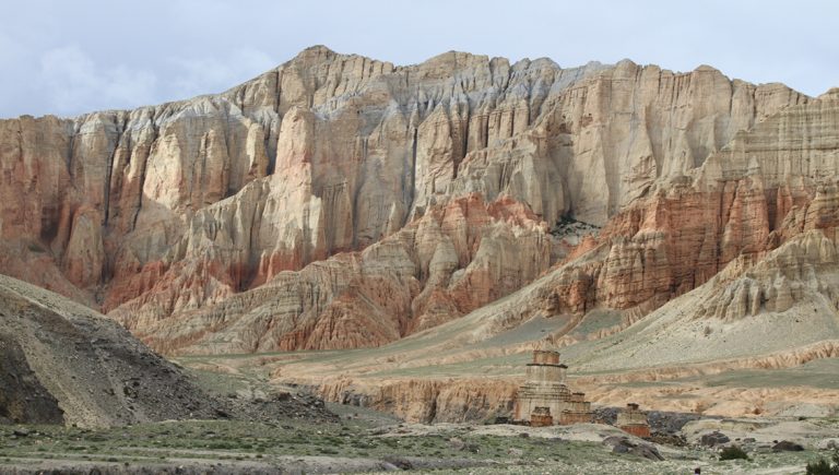
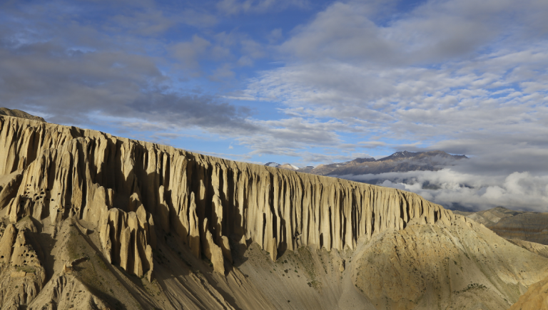
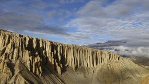
This geographical position gives Upper Mustang a noticeably different appearance from Nepal’s greener, wetter trekking regions. The landscape is characterized by dry river valleys, exposed cliffs, eroded rock formations, broad plateaus and settlements surrounded by cultivated land.
The Kali Gandaki valley provides an important approach to Mustang. Jomsom serves as a major gateway, while Kagbeni is a traditional entry point for the restricted Upper Mustang area. From Kagbeni, the route continues north through villages and high valleys toward Lo Manthang.
Unlike treks dominated by forest trails, Upper Mustang often involves walking across open terrain with limited shade. This makes wind, sun exposure, dust and access to drinking water important practical considerations, even when the altitude appears manageable.
Why Lo Manthang’s Elevation Matters
Lo Manthang is the historic walled settlement at the heart of Upper Mustang. At approximately 3,800–3,840 metres, it is high enough that trekkers should take altitude adaptation seriously, particularly if they have travelled quickly from lower elevations.
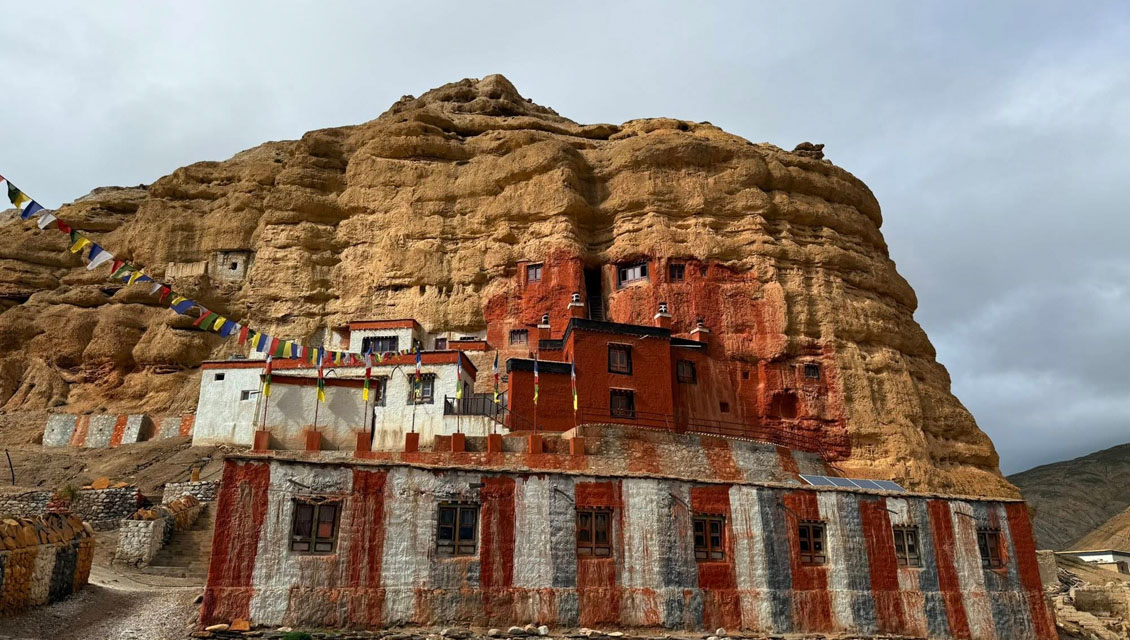
The settlement is more than a point on an elevation chart. It is a cultural destination with traditional architecture, monasteries, narrow lanes and a long association with the former Kingdom of Lo. Nepal Tourism Board identifies Lo Manthang as a major destination for experiencing the region’s cultural heritage.
Allowing time to explore the town is valuable for two reasons:
-
Cultural exploration: A full day can provide time to visit historic monasteries, explore the walled settlement and arrange an excursion to the nearby Chhoser cave area.
-
Altitude adjustment: Spending an additional night at the same elevation can provide time to adapt before continuing along a higher or more demanding return route.
A rest day does not guarantee protection from altitude sickness, and sightseeing at altitude can still be physically demanding. Plan the day at a comfortable pace rather than treating it as an opportunity to complete several strenuous excursions.
For cultural visits, follow the guidance of local caretakers, ask permission before photographing residents, and respect restrictions on photography inside monasteries.
How Difficult Is the Upper Mustang Trek at This Height?
Upper Mustang is not usually considered a technical mountaineering expedition on the classic trekking route. However, its altitude, exposed terrain and repeated ascents and descents can make it physically challenging.
The main difficulties are often the combination of conditions rather than elevation alone.
1. Walking above 3,000 metres
At higher elevations, some trekkers notice that their normal walking pace feels harder to maintain. Breathlessness during exertion, fatigue and headaches can occur, and individual responses to altitude vary.
A sensible itinerary should include gradual adjustment to altitude, manageable daily walking distances and flexibility if someone develops symptoms.
2. Repeated climbs and descents
The route does not climb continuously from Kagbeni to Lo Manthang. Trekkers ascend toward high points, descend into valleys, and climb again. Consequently, a day ending at a moderate sleeping altitude may still involve substantial uphill effort.
Look beyond the overnight elevation when comparing itineraries. Daily distance, total ascent, descent and time spent above 4,000 metres all help explain how demanding a day may be.
3. Wind and dry conditions
The rain-shadow landscape can be dry, dusty and exposed. Strong winds may make walking uncomfortable, particularly in open valleys and later in the day.
Practical recommendations include carrying eye protection, a buff or face covering, sun protection and enough drinking water for the planned stage. Ask your guide about the day’s route and wind conditions before setting out.
4. Cold nights and changing weather
Sunny afternoons can feel warm while temperatures fall sharply after sunset. Wind can make exposed sections feel colder than the thermometer suggests.
Pack layers that can be added or removed as conditions change, including a warm insulating jacket, a windproof outer layer, gloves and suitable sleeping arrangements.
Can You Get Altitude Sickness at 3,840 Metres?
Yes. Acute mountain sickness can develop at the elevation of Lo Manthang and at lower elevations in susceptible individuals. Physical fitness does not guarantee protection.
Common symptoms include headache, nausea, dizziness, unusual tiredness and loss of appetite. Symptoms should not automatically be dismissed as normal trekking fatigue.
For safer acclimatization:
-
Ascend gradually and avoid unnecessarily rapid increases in sleeping altitude.
-
Build rest or acclimatization time into the itinerary.
-
Walk at a pace that allows you to speak comfortably rather than pushing to keep up with faster trekkers.
-
Drink regularly and eat enough to maintain energy.
-
Tell your guide promptly if you develop symptoms.
If symptoms develop or worsen, do not continue ascending until the situation has been assessed. Severe breathlessness at rest, confusion, difficulty walking straight or a worsening condition at altitude requires urgent medical attention and descent where appropriate.
For medical guidance, consult the CDC’s Yellow Book guidance on high-altitude travel
These recommendations are general preparation guidance, not a substitute for an individual medical assessment. If you have relevant health concerns or have previously experienced altitude illness, discuss your itinerary with a qualified healthcare professional before departure.
What Is the Best Time to Trek Upper Mustang?
Upper Mustang’s rain-shadow location makes it an alternative to many Nepal trekking regions during the summer monsoon. However, that does not mean conditions are identical throughout the year or that every trail is always accessible.
Nepal Tourism Board notes that Upper Mustang can be visited during the monsoon because of its rain-shadow geography, while also warning that winters are cold and windy.
Spring: March to May
Spring offers opportunities to explore the dry valleys and traditional settlements as temperatures gradually warm. Conditions can still be cold at night, and wind or residual snow may affect higher sections.
Summer monsoon: June to August
Upper Mustang is relatively sheltered from the heaviest monsoon rainfall affecting much of Nepal. Nevertheless, road access, flight schedules and local trail conditions can be affected by weather elsewhere along the approach.
Travellers should confirm transport arrangements and local conditions before departure rather than assuming the rain shadow eliminates all weather-related disruption.
Autumn: September to November
Autumn is a popular period for trekking in Nepal. Upper Mustang can offer clear views and comfortable daytime walking conditions, although nights become colder as the season progresses.
Winter: December to February
Winter brings colder temperatures, potential snow and difficult conditions on exposed trails. Some services may be limited, and strong winds can add to the challenge. Winter travel requires a more careful assessment of weather, accommodation and route accessibility.
Practical recommendation: Choose dates based on your preferred conditions, available time and tolerance for cold, not just a general claim that one season is always best. Confirm the current forecast and itinerary with a local trekking operator before travelling.
Upper Mustang Height Compared With Other Trekking Destinations
Elevation comparisons can help travellers understand the physical demands of a trip, but they should not be treated as a direct ranking of difficulty.
| Destination | Approximate elevation | What it means for trekkers |
|---|---|---|
| Jomsom | 2,720 m | Gateway to the Mustang region |
| Lo Manthang | 3,810–3,840 m | High-altitude cultural destination |
| Annapurna Base Camp | Around 4,130 m | Higher overnight destination on the standard route |
| Thorong La Pass | 5,416 m | Much higher pass on the Annapurna Circuit |
The figures for Annapurna Base Camp and Thorong La refer to different types of trekking points: one is a destination and the other a mountain pass. Neither should be compared directly with Lo Manthang without considering the route profile. Thorong La is a nearby Annapurna-region reference, not a pass on the standard Upper Mustang trek.
The main advantage of understanding Upper Mustang’s elevations is being able to assess the route realistically: its overnight stops are generally lower than the highest points of many high-pass Himalayan expeditions, but the altitude is still sufficient to require thoughtful preparation.
What Should You Pack for Upper Mustang’s Elevation?
Your packing list should account for cold nights, intense sunlight, wind and dry conditions.
Recommended items include:
-
Layered trekking clothing, including thermal base layers.
-
A warm insulated jacket and windproof outer shell.
-
Broken-in trekking boots with good grip.
-
Warm socks, gloves, a hat and a sun hat.
-
UV-protective sunglasses and high-SPF sunscreen.
-
A reusable water bottle or hydration system.
-
Water-treatment supplies suitable for your route.
-
Personal medication and a basic first-aid kit.
-
A headlamp, power bank and spare charging cable.
-
A buff or face covering for dusty and windy stretches.
Your guide or operator should advise you on any additional equipment needed for the specific season and itinerary. The exact requirements depend on accommodation, transport, expected weather and whether you are trekking independently of vehicle support.
Upper Mustang Permits and Local Trekking Requirements
Upper Mustang is a restricted trekking area. Foreign visitors should arrange the required special permit and travel in accordance with the applicable government rules.
The Nepal Department of Immigration’s restricted-area permit information currently lists a fee of US$50 per person per day for the designated Upper Mustang restricted area. The applicable boundaries and requirements should be checked against the official notice before booking.
Nepal Tourism Board also lists Upper Mustang among the routes for which trekkers must check the relevant guide and TIMS requirements.
Before departure, ask your trekking company to confirm:
-
The current permit fee and the number of chargeable days.
-
The permitted route and applicable entry requirements.
-
Whether your planned itinerary includes any additional restricted areas.
-
Guide arrangements and any required documentation.
-
Transport, accommodation and contingency plans.
Permit policies and administrative details can change. Verify them with the relevant government authority rather than relying on an old blog post or a previous year’s quotation.
Plan Your Upper Mustang Trek With Local Guidance
Understanding the elevation of Upper Mustang helps you prepare for more than just the numbers on a map. It helps you choose a sensible itinerary, anticipate changes in weather, recognize the demands of walking above 3,000 metres and allow enough time to appreciate the region’s distinctive cultural heritage.
For route-specific information, start with the Upper Mustang Trek package from Mustang Trekking. Before booking, ask the team to confirm overnight elevations, the highest passes on your chosen itinerary, expected daily walking hours and current permit requirements.
A useful final planning tip: Request the elevation profile for your exact itinerary, not just a general map of Upper Mustang. The difference between a village’s sleeping altitude and a pass crossed during the day can materially affect how you prepare.